Exploring the Digital Twin of the Mediterranea basin

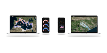
A digital twin of the Mediterranean basin has been developed to improve knowledge of the water cycle with the use of satellite images.
The model allows for the simulation of different situations and scenarios useful for understanding hydrogeological phenomena and their impact on the territory for a better management of extreme events.
The project, besides implementing new hydrogeological models, made use of the ADAM technology for the development of the DTE Hydrology platform, for interactive simulation and visualization of the digital twin data. The platform is used to study phenomena related to climate change such as the impact of extreme events (floods, droughts, …) on industrial, agricultural and civil activities to optimise the management of water resources.
Starting from the case study of the Po River Basin, the model was extended and, today, it allows the study of the entire Mediterranean basin.
Funded by the European Space Agency, the project did foresee the collaboration of MEEO with the Hydrology group of the CNR IRPI, CIMA Foundation, University of Perugia, TU Wien, UGent, EODC GmbH, University of Bologna, EURAC Research and University of Valencia.
The full article is available here: A Digital Twin of the terrestrial water cycle: a glimpse into the future through high-resolution Earth observations

